-
Call Us
+353 (0) 64 663 4009 -
Email
info@killarney-earlscourt.ie
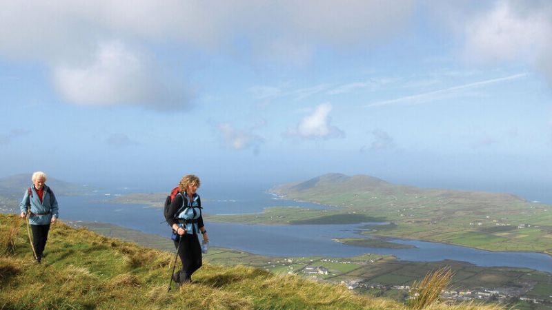
Walking & Hiking
Killarney National Park
For the active, walking and cycling are two of the best ways to see the National Park. The network of surfaced tracks in the Muckross, Knockreer, and Ross Island areas is ideal for both cyclists and walkers. Bicycles can be rented from many locations in and around Killarney Town. Our Killarney Hotels location is perfect for hiking enthusiasts. Killarney is surrounded by 25,000 acres of National Park, lakes and magnificent Mountain Ranges including Ireland's highest peak, Carrantuohill at 1040 metres. Nature lovers will enjoy the Knockreer House and Gardens for its beautiful fauna and flora, a short stroll across from the Cathedral in Killarney. We can recommend the best local guides with a vast knowledge of the area.
Muckross & Dinis Walk
Dinis Island is situated in Killarney National Park looking out over the Middle Lake. The cottage has been described as a hunting lodge and dates back to the 1700s. The Old Weir Bridge and the Meeting of the Waters are within walking distance of the cottage. It is possible to walk or cycle through the Muckross peninsula to Dinis. This is a one-way route for bicycles as it is a narrow winding road with some dangerous bends and the return journey to Killarney is via the N71. It can also be accessed via a pleasant walk along the lake from the car park on the N71 approx 6 kilometres from Killarney.
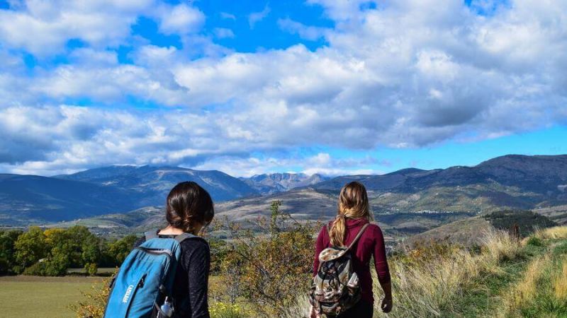
Whether you wish to trek to the top of Ireland's highest mountain range, explore Killarney's ancient woodland glens and valleys or just stroll around its beautiful lakeshore walks, Killarney offers you a range of walks in the unspoilt wilderness that will never cease to amaze and please you.
Earls Court is also perfectly located among Kerry Hotels for taking on the beautiful scenic and historic "Kerry Way", Dingle Way, and Beara Way walk through the three Peninsulas of the Ring of Kerry, Dingle and Beara.
Route maps and pocket guides are available for the recognised established routes, but Killarney offers the pleasure of numerous walking options eg Derrycunnihy to Mucross or Lord Brandon's cottage and many that are still very much in their undiscovered state, presenting the walker with the opportunity to explore and discover.
Torc Waterfall and Mountain
Torc Waterfall is approximately 7 kilometres from Killarney town and approx 2.5 kilometres from the main entrance to Muckross House and can be accessed from a car park on the N71 better known as the Killarney – Kenmare road. A short walk of approx 300 metres brings you to the waterfall. From that point, steps lead to another viewing point at a higher altitude that provides a view over the Middle Lake. The path is also part of the Kerry Way, a long-distance walking route and a starting point for circular walking routes which are indicated by a map down at the start of the trail beside the car park. The waterfall is approximately 20 metres high and is at its best after heavy rainfall. Continue up the steps towards Torc mountain for breathtaking views or across the road from the car park, jaunting cars can be hired for a trip to Muckross House within the National Park.
The Old Kenmare Road
This moderate walk follows the original road to Kenmare. The total length of the old road is 16 kilometres to Kenmare and will take about five hours. This delightful walk takes you along mountain meadows where herds of Red Deer frequently graze. In Esknamuky Glen, the furrows and stone walls of a pre-famine village are still visible, providing a stark reminder of harsher times. There are spectacular views of the surrounding mountains throughout with plenty of pleasant spots to picnic.
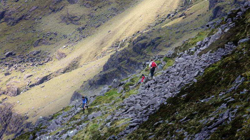
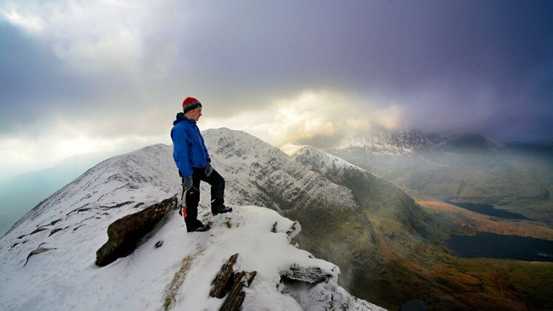
Carrauntoohil
Carrauntoohil at 1,040 metres is Ireland's highest mountain located near Killarney in County Kerry. This mountain is privately owned and the surrounding slopes are actively farmed. Therefore, dogs are not permitted on Carrauntoohil. Please respect the wishes of the local landowners – without their goodwill, access to the mountain would not be possible.
Carrauntoohil is often climbed as part of longer mountain walking routes in the MacGillycuddy's Reeks range, including the Coomloughra Horseshoe or the MacGillycuddy's Reeks Ridge Walk of the entire mountain range.
The straightforward route is via the Devil's Ladder, which starts at Cronin's Yard in the northeast. Alternative to the Devils Ladder is The Brother O’Shea’s Gully route and The Caher route, a long route that takes in Ireland’s third-highest mountain en route to the summit of Carrauntoohil Mountain
Walkers should follow the following safety recommendations:
Always tell someone of your intended route and return time.
Take a fully charged phone and a power bank with you, to help locate you in the event of an accident.
The Carrauntoohil hike shouldn’t be attempted by novice climbers (unless accompanied by a guide).
Make sure that you have the relevant map for your walk.
Bring additional warm clothing and hot drinks.
Wear proper footwear; bring a whistle, and a compass.
For more information, we advise you to visit some of the useful websites.
Kerry Mountain Rescue - https://kerrymountainrescue.ie/
Kerry Climbing - https://www.kerryclimbing.ie/
Reeks District - https://reeksdistrict.com/
Kerry Biosphere - https://kerrybiosphere.ie/
Killarney - https://killarney.ie/
Discover Kerry - https://www.discoverkerry.com/en/